|
|
 |
Professional Geographic / GIS / GPS / Cartographic Development Projects
- Utilizing various data sources such as U.S. Census and world wide data from TeleAtlas, maps showing pertinent business information were generated using SAS GMAP and/or Caliper Maptitude products. Thousands of maps can be generated for Web, application user interfaces, or general purposes in any popular graphics fomat. This was a very effective, high quality and low cost solution to more expensive products on the market.
|
Geographic Programming and Analysis:
- Visual Maps with Business Data
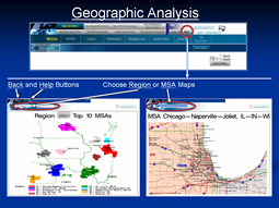
Design of an automated business data mapping system
- Includes all business regions, districts, territories and MSA's (metropolitan areas)
- Interactive user reports, with location (or any other data) chosen.
- Overlays and markers for business data
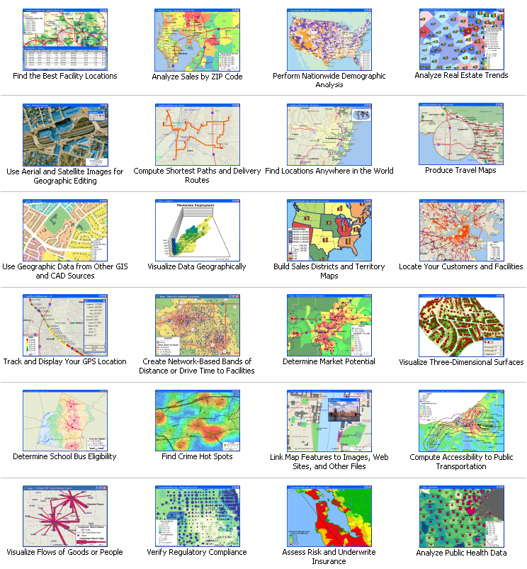
I can also produce a wide variety of other geographic reports:
|